Design framework for urban landscapes through point cloud modelling
Integrating CFD simulation into urban design could help us achieve optimal configuration of urban elements to maximise the provision of ecosystem services.
The built environment is a complex adaptive system. In order to maximise the provision of ecosystem services provided by vegetation in cities, the physical forms and physical dynamics of urban landscapes need to be better understood.
In urban landscape design, current digital modelling methods stagger to fully address physical forms and dynamics in the environment. This limits the possibility of integrating scientific evidence when developing spatial configurations of elements in urban landscapes, such as vegetation, open spaces, building forms and orientation.
Currently, remote sensing technology such as laser scanning has been used to measure physical forms in order to reproduce them as geo-specific digital 3D models, while dynamic simulation is widely used to predict how scenarios will perform under given conditions. However, there is still a need for a holistic design process that is capable of integrating both the measured physical forms and physical dynamics.
To better analyse and shape urban landscapes, a simulation-based design framework was developed using point cloud modelling to evaluate design scenarios iteratively for ecosystem service performance. The study was conducted by Dr Philipp Urech and Dr Muhammad Omer Mughal from the Future Cities Laboratory’s Ecosystem Services in Urban Landscapes research module, together with Dr Carlos Bartesaghi-Koc.
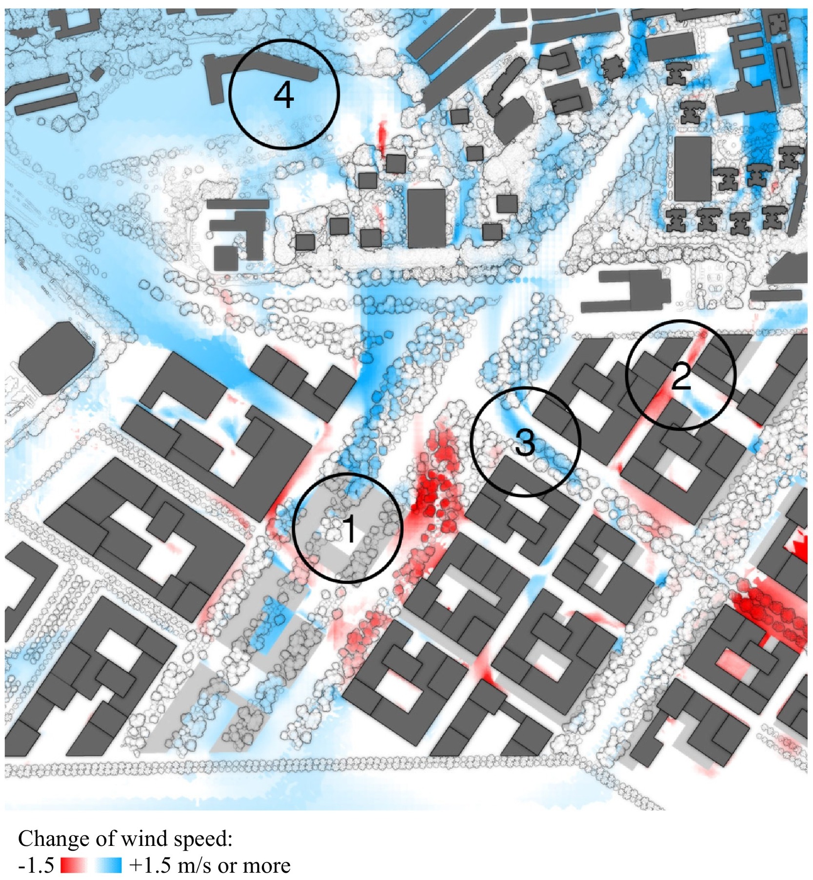
The proposed framework is applied to Tanjong Pagar in Singapore, where spatial configurations of vegetation are assessed for their performance through an iterative comparative analysis of each scenario. In the case study, a site-specific design approach used, involving iteratively modelling of the laser-scanned point cloud model. A workflow is then developed to convert the geometric data from the point cloud models into inputs for computational fluid dynamics (CFD) simulation, which is integrated into design development. The configurations of vegetation are then compared to identify the scenario with the best ecosystem service performance.
This design framework provides accurate scientific feedback to support city managers, planners, urban and landscape designers in decision making. By guiding the design process with the consideration of the built environment as a complex adaptive system, it is possible to maximise ecosystem services in cities and mitigate dynamic events such as urban heat islands.
The study external page 'A simulation-based design framework to iteratively analyze and shape urban landscapes using point cloud modeling' is published in Computers, Environment and Urban Systems.
Urech, P. R. W., Mughal, M. O., & Bartesaghi-Koc, C. (2022). A simulation-based design framework to iteratively analyze and shape urban landscapes using point cloud modeling. Computers, Environment and Urban Systems, 91, 101731. external page https://doi.org/https://doi.org/10.1016/j.compenvurbsys.2021.101731