Mapping Covid-19 in Makassar
FCL has been working with the Asian Development Bank and the city of Makassar in Indonesia to answer urgent questions about how Covid-19 interacts with cities and to support pandemic management.
The rapid spread of the pandemic has drawn attention to how Covid-19 interacts with cities, where the highest concentration of people are found. It provokes urgent questions, such as: have cases concentrated in some areas and not others? What sorts of patterns of incidence can we observe in cities? If so, are there urban areas that require immediate intervention to mitigate adverse effects?
These questions would not only uncover the number of Covid-19 cases, but also where they are located in the city. They also call for some knowledge about the character of those locations, be it expressed as the population density of a neighbourhood, the configuration of the street network, the provision of public opens space, access to public transport or even the quality of the street food.
Like many cities in Indonesia, Makassar has been energetically collecting various data pertinent to viral transmission around the clock – this has been especially demanding, as Makassar is the epicentre of the pandemic in South Sulawesi. Public health authorities in Makassar have been working hard to improve the baseline by increasing testing, supported by the provincial government who provided 20,000 rapid testing kits. Over 7,000 traditional market vendors were tested on May to June, for example. In spite of that, the picture remains incomplete.
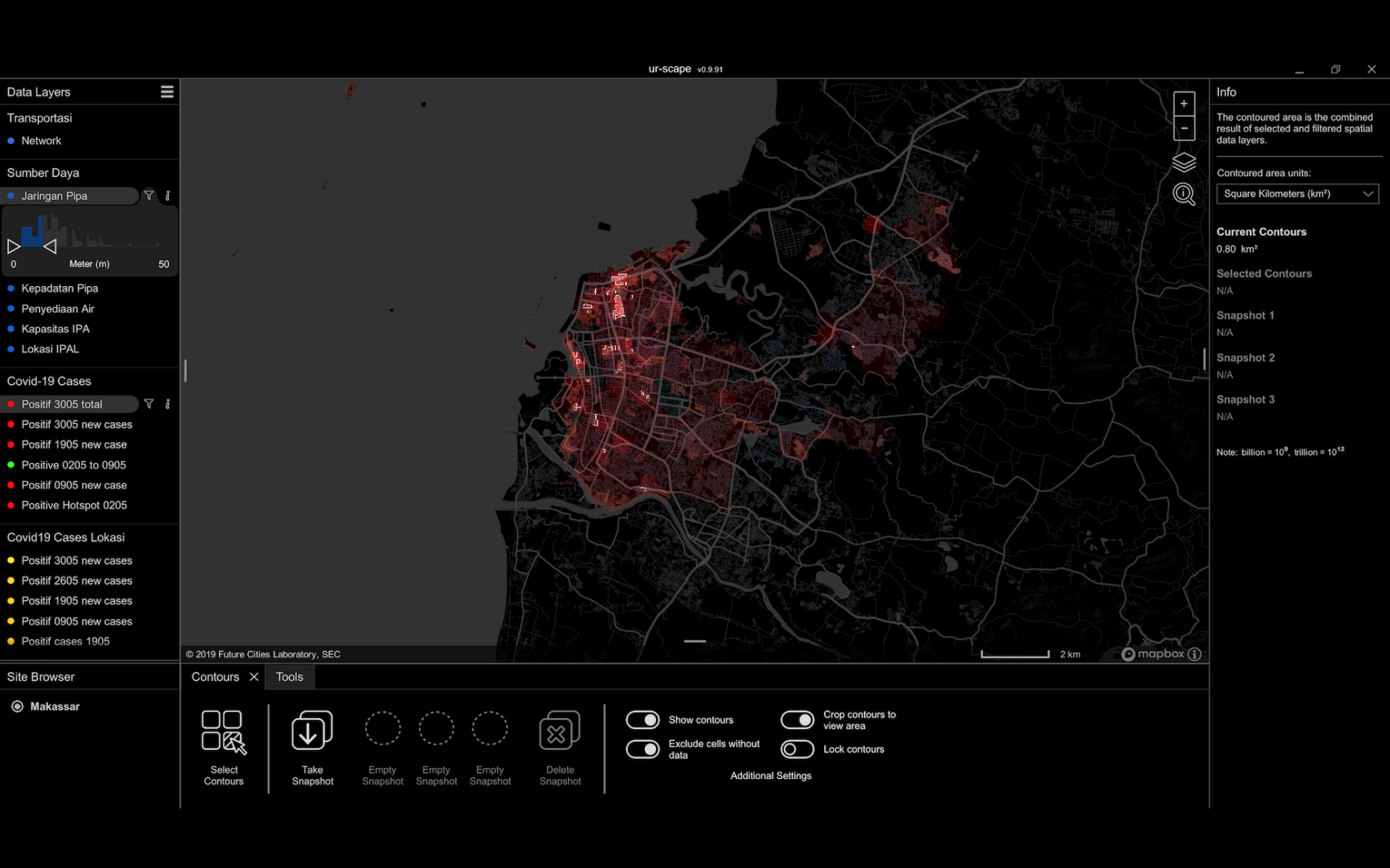
Future Cities Laboratory (FCL) has been working with the Asian Development Bank (ADB) and the city of Makassar, capital of South Sulawesi province in Indonesia, to answer these urgent questions. Together, we analysed and visualised Covid-19-related data in that city and worked with experts in public health to identify missing data needed to inform longer-term policy-making efforts and the planning and design of a post-Covid-19 Makassar. These data include population density, clean water provision, distribution of public facilities, slum locations, street network configuration and location of transport hubs.
Using the ur-scape software, this study by Prof. Stephen Cairns, Dr Devisari Tunas and Niraly Mangal combined Covid-19 data with spatial data from the city to identify regions where they intersected. The data suggests a socio-economic divide in Covid-19 transmission pattern, with hotspots concentrating in areas that generally contain populations at higher densities and lower-incomes, such as slums and areas with less access to water.
There is clear need to institute relevant mitigation measures in the dense downtown areas, focus attention on those poorest neighbourhoods within this areas, and increase steps to gather fine-grained data at the neighbourhood level.
Indonesia is still registering positive Covid-19 cases daily. Despite that, most Indonesian cities, including Makassar, have lifted a blanket city-wide social distancing policy, in order to transition into what they define as the ‘new normal’. Analysis of existing data helps to manage this transition by identifying vulnerable areas for closer monitoring, and devise necessary strategies for pandemic mitigation.
The work undertaken by FCL, ADB and the city of Makassar, with the help of spatial planning software such as ur-scape, is a useful example of a rapid response to Covid-19. The approach has supplemented the relatively static standard categories used by the Ministry of Health with a much broader set of spatial, temporal and social data. It also involved visualising such data on the fly, thereby facilitating broader engagement with the data across a whole range of city and public health actors, be they government officials, academic partners or community groups. This helped to broaden the base for policy making, without relying exclusively on case-incidence and population density.
The disciplines of public health and city planning have a long history of interaction. In nineteenth- and twentieth-century Europe, city building types, neighbourhoods, streets, plumbing and transport infrastructure have all been reshaped to reduce the spread of diseases such as smallpox, typhoid, cholera and polio. The Covid-19 pandemic reminds us of this history and the urgency of ensuring that we bring the best available expertise, software and data infrastructure to support pandemic management immediately, and to support medium- and longer-term planning for the post-Covid-19 era.