Augmenting reality in urban design and planning
Prof. Bige Tuncer describes how big data and its augmented‐reality projections can be used to facilitate better urban design strategies and understanding in a paper in Architectural Design.
What can designers learn from users’ of urban spaces? Data of people’s movement around cities and their social media feeds, when projected in augmented reality, can facilitate better urban design strategies and understandings, Prof. Bige Tuncer principal investigator of Big Data Informed Urban Design and Governance wrote in Architectural Design.
The success of evidence-based design, however, is dependent on the framing of the issues to be explored and the decision as to which urban datasets and their combination can eventually yield the desired evidence. In the context of planning and design, qualitative and quantitative, big and small datasets are combined, she wrote in the article external page Augmenting Reality: (Big) Data-Informed Urban Design and Planning
The challenge lies in finding out which behavioural hypotheses can be drawn from specific urban datasets and their combination and what is the relationship of these hypotheses to the spatial and organisational aspects of urban spaces.
Therefore, instead of data-driven design, we should be looking into design-driven data .This method uses multi-source, multi-scale and multi-time data and information, and the evidence derived from this combination to augment reality, so that (big) data can offer important contribution to design processes.
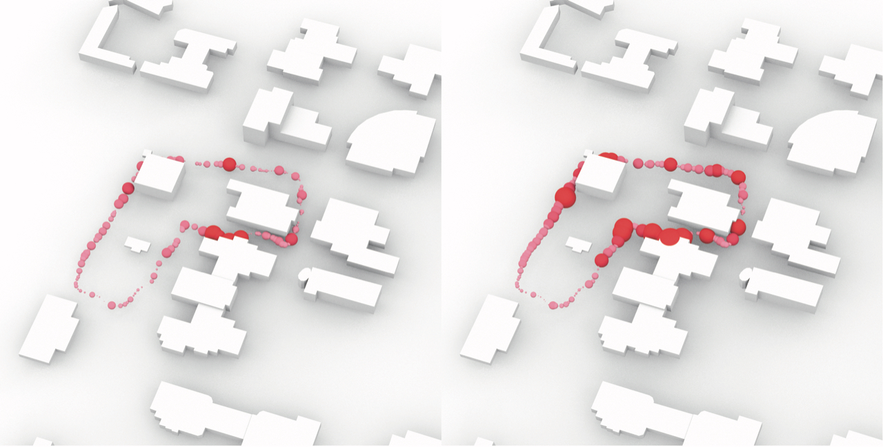
One application is the conduciveness of the urban street network in Singapore in promoting active lifestyle and wellbeing, i.e.walking for fitness, jogging, and running. Using spatial statistical models, one can understand the influence of urban features on behaviour, such as the positive effect of recreational areas as destinations, naturalness and certain road types on leisure walks. The model also disproved widely discussed features in walkability studies such as the presence of business, commercial and residential land uses.
Another topic is cultural planning, especially the effect that social media have on the creation and consumption of art, and how modern cultural planning practices can take this into account. Social media is modifying the way experts and non-experts produce, collect and refer to works of art in urban environments, shifting these activities away from solely galleries and museums.
In addition to gaining an understanding of existing environments for improvements or future policymaking, the (big-)data-driven-urban design and planning approach can also be used for public spaces that may not yet exist. A visit potential model is being developed at the Future Cities Laboratory, which can estimate the potential presence of people in public spaces and the effect of urban design quality on this potential. This model demonstrates how morphology, landuse and public space qualities influence where people go.
The future of augmented reality and virtual reality in bringing together the strengths of humans, data analytics and artificial intelligence is promising. As data visualisation and physical space design become increasingly intertwined, both have a high potential in design conceptualisation and in transparent participation and governance strategies.